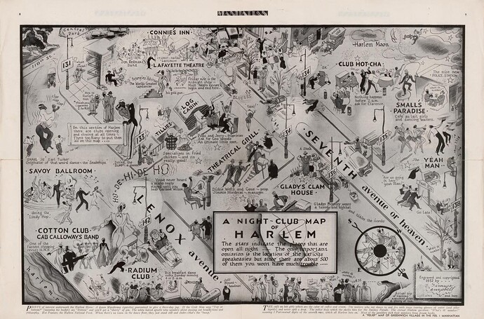
- Pictorial map of entertainment, restaurant, and speakeasy facilities in the Harlem district, Manhattan, New York City.
-
- At foot of principal title: The stars indicate the places that are open all night. The only important omission is … the various speakeasies but since there are about 500 of them you won’t have much trouble.
-
- Oriented with north toward the lower right.
-
- Purchase; Madison Council using Edwin L. Cox American Legacy funds; 2016.
-
- The map sheet has been removed from the folded periodical newspaper: Manhattan–a weekly for wakeful New Yorkers, January 18, 1933, pages 7 to 10.
-
- The copyright date given within the map border is 1932; on page 3 of the accompanying newspaper it is 1933.
-
- LC copy imperfect: Use-worn, torn at fold lines, page edges wrinkled.
-
- Accompanied by folded newspaper: Manhattan published weekly and copyrighted 1933 by Dell Publishing Company, Inc. … Volume 1, Number 1, January 18, 1933, 16 pages.
-
- Includes text in lower margin, location notes in map area, pictorial compass rose, and the personal names of club/restaurant proprietors.
-
- Text and humorous illustrations on verso.
1 Like
